Satellite-based Crop Health Monitoring Applications
- Early detection of nutrient deficiencies & water stress
- Precision water management
- Pest and disease management
- Soil Health Monitoring
- Precision farming
- Timely Farm Management
- Boosting Crop Productivity
- Irrigation Optimization
NDVI in Maharashtra
A REGIONAL CASE STUDY
To truly understand how powerful NDVI is, let's look at a real-world example: agriculture in Maharashtra. By analyzing satellite data from different seasons, we can see how NDVI values reveal the secrets of crop health and highlight problems like drought and extreme weather. This shows how a simple number can tell a complete story about a region's crops.
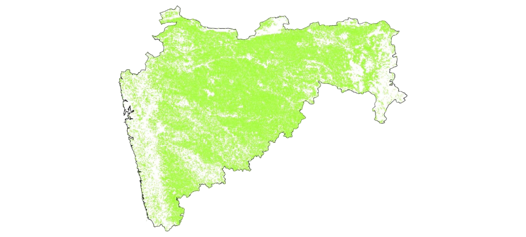


Satellite Imagery in Maharashtra
Year: 2025
- Replaced traditional field surveys with satellite-based crop assessments.
- Standardized NDVI for damage evaluation across the state.
Crop Area Allocation
% of Cultivable Land under Different Crop Categories
- Maharashtra is the second largest producer of oilseeds like soybean (28.14%) in the country.
- While food grains dominate in area, cash crops and oilseeds contribute more to the state's economy.
Haryana Story
- NDVI and NDWI helped resolve insurance disputes in Bhiwani district, Haryana.
- Satellite-based verification provided independent, reliable estimates.
- NDVI is integrated into Pradhan Mantri Fasal Bima Yojana, India's crop insurance program.
Uttar Pradesh Story
Year: 2022
- NDVI was used to assess drought vulnerability
- Boosting crop performance
(Rice, Wheat, Cotton, Sugarcane, etc.)
for Paddy, Wheat & Mustard
& Food Security
AI-powered NDVI Applications
Integrating Satellite Data with IoT & Deep Learning
AI-powered NDVI Applications
Integrating Satellite Data with IoT & Deep Learning
- Modern NDVI applications leverage Artificial Intelligence for enhanced precision.
- Deep learning models combine satellite NDVI data with IoT sensor inputs.
- Modern NDVI applications leverage Artificial Intelligence for enhanced precision.
- Deep learning models combine satellite NDVI data with IoT sensor inputs.
Calendar card for different cropping seasons.
Line graph to show yield per bushel.
map for area cultivated in maharashtra
Another line graph
Calendar card for different cropping seasons.
Line graph to show yield per bushel.
map for area cultivated in maharashtra
Another line graph
Centre of Data for Public Good
CDPG is a pioneering initiative dedicated to harnessing the power of data and technology for meaningful societal impact. Grounded in translational research and real-world impact, CDPG has developed software platforms, AI/ML models, innovative applications, and data policies that unlock the potential of data for the public good. It is a transformative initiative of the Ministry of Housing and Urban Affairs, Government of India to provide a data exchange platform to Indian cities. The platform has been developed by the Smart Cities Mission and is implemented by the Indian Institute of Science (IISc), Bengaluru.
